

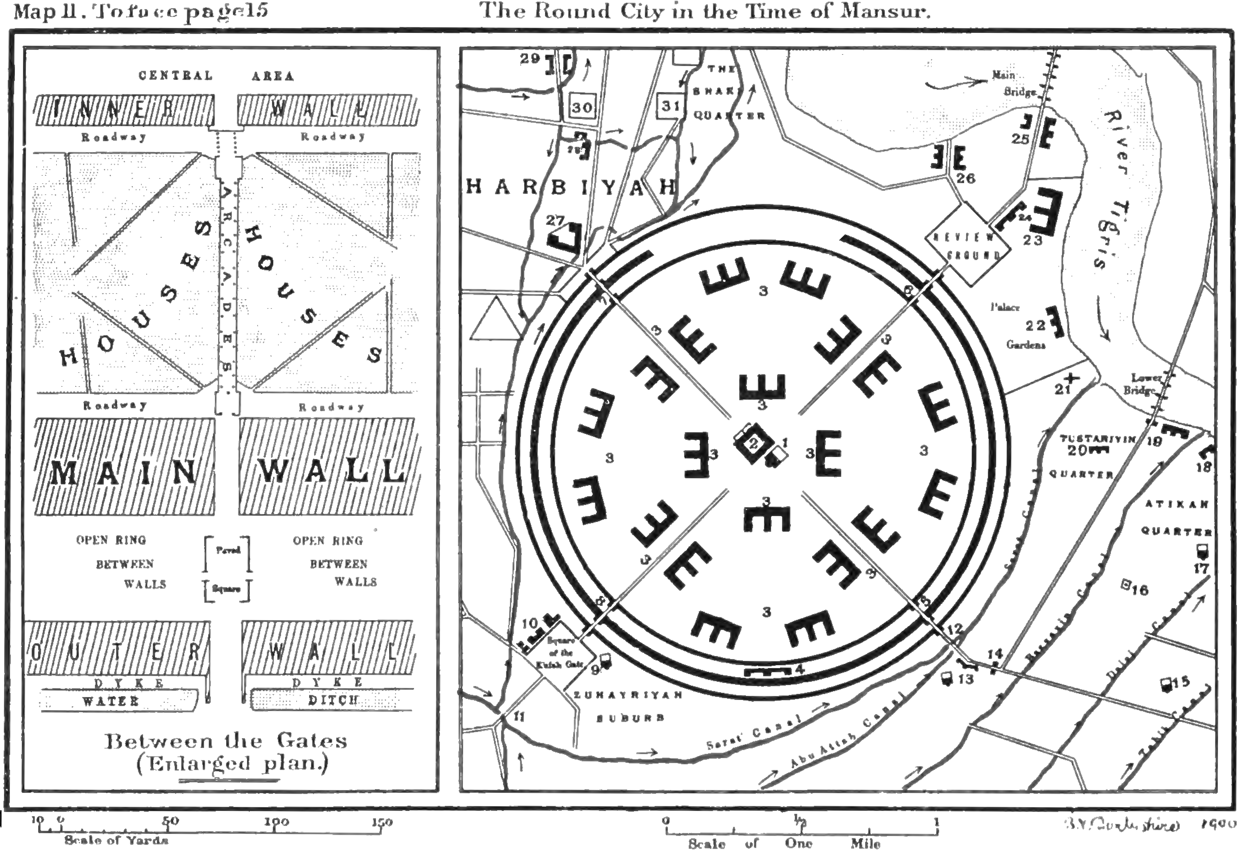
Reconstruction of Mansur's city —1900map

إعادة تركيب مدينة المنصور — خريطة1900

Le Strange's MapII published1900,not an original762document or precise survey of every phase.

Depth

At a glance

Line map dated1900: circular city,four entrances,central palace/mosque,river and canals,with enlarged wall/passage inset and scales; no people.
Guy Le Strange,Baghdad During the Abbasid Caliphate,Clarendon Press,Oxford1900,MapII,toface15; exact Commonsfile Round City in the Time of Mansur (Le Strange).png,public domain:https://creativecommons.org/publicdomain/mark/1.0/. · Licence: PD · Open full image

This entry is a record so far, without an article. The facts and connections below come from the museum's data.

Sources

  • Mansur round-city map catalogue — Commons
  • Baghdad During the Abbasid Caliphate — Le Strange1900
Cite this page

islam.museum contributors. “Reconstruction of Mansur's city —1900map”. islam.museum, https://islam.museum/en/media/round-city-lestrange-plan/. CC BY-SA 4.0. Last updated 2026-11-20.

Improve this page on GitHub · Report an error · Help complete it · JSON